
HISTORY OF THE
GREAT BENIN KINGDOM
Eheneden Erediauwa, Omo N’Oba N’Edo Uku’ Akpolokpolo Ewuare 11 – The 40th Oba of Benin kingdom.
The original people and founders of the Benin Kingdom, the Edo people, were initially ruled by the Ogiso (Kings of the Sky) who called their land Igodomigodo. The first Ogiso (Ogiso Igodo), wielded much influence and gained popularity as a good ruler. He died after a long reign and was succeeded by Ere, his eldest son. In the 12th century, a great palace intrigue erupted and crown prince Ekaladerhan, the only son of the last Ogiso was sentenced to death as a result of the first queen (who was barren) deliberately changing an oracle’s message to the Ogiso. In carrying out the royal order that he is killed, the palace messengers had mercy and set the prince free at Ughoton near Benin. When his father the Ogiso died, the Ogiso dynasty officially ended. The people and royal kingmakers preferred their late king’s son as the next to rule.
The exiled Prince Ekaladerhan had by this time changed his name to Izoduwa (meaning ‘I have chosen the path of prosperity’) and found his way to Ile-Ife. It was during this period of confusion in Benin that the elders, led by Chief Oliha, mounted a search for the banished Prince Ekaladerhan – whom the Ife people now called Oduduwa. Oduduwa, who could not return due to his advanced age, granted them Oranmiyan, his grandson, to rule over them. Oranmiyan was resisted by Ogiamien Irebor, one of the palace chiefs, and took up his abode in the palace built for him at Usama by the elders (now a coronation shrine). Soon after his arrival, he married a beautiful lady, Erinmwinde, daughter of Ogie-Egor, the ninth Enogie of Egor, by whom he had a son.[citation needed] After residing there for some years he called a meeting of the people and renounced his office, remarking in vexation Ile-Ibinu (“ile” means land, “binu” mean anger, and thus the kingdom was called Ibinu, which was mispronounced Bini in the 15th and 16th centuries by the Portuguese). This was out of frustration as he often expressed that “only a child born, trained and educated in the arts and mysteries of the land could reign over the people”. He arranged for his son born to him by Erinmwinde, Eweka, to be made king in his place, and returned to Yorubaland thereafter. His son the new king was soon found to be deaf and dumb, and so the elders appealed to Oranmiyan. He gave them charmed seeds known as “omo ayo” to play with, saying that to do so will make him talk. The little Eweka played with the seeds with his peers at Useh near egor, his mother’s hometown. While playing with the seeds, he announced “Owomika” as his royal name. Thus, he gave rise to the tradition of the subsequent Obas of Benin spending seven days and nights at Usama before proceeding to announce their royal names at Useh. Eweka thus started a dynasty that now bears his name. Oranmiyan went on to serve as the founder of the Oyo Empire, where he ruled as the first Alaafin of Oyo. His descendants now rule in Ile Ife, Oyo and Benin.
Estimates for the initial construction of the walls range from the first millennium to the mid-fifteenth century. According to Connah, oral tradition and travellers’ accounts suggest a construction date of 1450–1500. It has been estimated that, assuming a ten-hour work day, a labour force of 5,000 men could have completed the walls within 97 days, or by 2,421 men in 200 days. However, these estimates have been criticized for not taking into account the time it would have taken to extract the earth from an ever-deepening hole and the time it would have taken to heap the earth into a high bank. It is unknown whether slavery or some other type of labour was used in the construction of the walls.
By the 1st century BC, the Benin territory was partially agricultural; and it became primarily agricultural by around 500 AD, but hunting and gathering remained important. Also by 500 AD, iron was in use by the inhabitants of the Benin territory.
Benin City (formerly Edo) sprang up around 1000, in a forest that could be easily defended. The dense vegetation and narrow paths made the city easy to defend against attacks. The rainforest, in which Benin City is situated, helped in the development of the city because of its vast resources — fish from rivers and creeks, animals to hunt, leaves for roofing, plants for medicine, ivory for carving and trading, and wood for boat building — that could be exploited. However, domesticated animals, from the forest and surrounding areas, could not survive, due to a disease spread by tsetse flies; after centuries of exposure, some animals, such as cattle and goats, developed a resistance to the disease.
The original name of the Benin Kingdom, at its creation sometime in the first millennium CE, was Igodomigodo, as its inhabitants called it. Their ruler was called Ogiso (Ruler of the sky). Nearly 36 known Ogiso are accounted for as rulers of this initial incarnation of the state.
Depiction of Benin City by a Dutch illustrator in 1668. The wall-like structure in the centre probably represents the walls of Benin. The Walls of Benin are a series of earthworks made up of banks and ditches, called Iya in the Edo language in the area around present-day Benin City, the capital of present-day Edo, Nigeria. They consist of 15 kilometres (9.3 miles) of city iya and an estimated 16,000 kilometres (9,900 miles) in the rural area around Benin. Some estimates suggest that the walls of Benin may have been constructed between the thirteenth and mid-fifteenth century CE and others suggest that the walls of Benin (in the Esan region) may have been constructed during the first millennium AD.
The Benin City walls have been known to Westerners since around 1500. Around 1500, the Portuguese explorer Duarte Pacheco Pereira briefly described the walls during his travels. Another description given around 1600, one hundred years after Pereira’s description, is by the Dutch explorer Dierick Ruiters.
Pereira’s account of the walls is as follows:
This city is about a league long from gate to gate; it has no wall but is surrounded by a large moat, very wide and deep, which suffices for its defence.
The archaeologist Graham Connah suggests that Pereira was mistaken in his description by saying that there was no wall. Connah says, “[Pereira] considered that a bank of earth was not a wall in the sense of the Europe of his day.”
At the gate where I entered on horseback, I saw a very high bulwark, very thick of earth, with a very deep broad ditch, but it was dry and full of high trees… That gate is a reasonable good gate, made of wood in their manner, which is to be shut, and there always there is watch holden. By the 15th century, Benin had expanded into a thriving city-state. The twelfth Oba in the line, Oba Ewuare the Great (1440–1473) would expand the city-state’s territories to surrounding regions.
It was not until the 15th century, during the reign of Oba Ewuare the Great, that the kingdom’s administrative centre, the city of Ubinu (or Ibinu), began to be known as Benin City by the Portuguese, a pronunciation later adopted by the locals as well. The Portuguese would write this down as Benin City. Edo’s neighbours, such as the Itsekiris and the Urhobos, continued to refer to the city as Ubini up until the late 19th century.
Aside from Benin City, the system of rule of the Oba in the empire, even through the golden age of the kingdom, was still loosely based upon the Ogiso dynasty’s tradition, which was military protection in exchange for pledged allegiance and taxes paid to the royal administrative centre. The language and culture was not enforced, as the empire remained heterogeneous and localized according to each group within the kingdom, though a local enogie (or duke) was often appointed by the Oba for specific ethnic areas.
Description
Benin in 1897
The walls were built of a ditch and dike structure; the ditch was dug to form an inner moat with the excavated earth used to form the exterior rampart. The Benin Walls were ravaged by the British in 1897 during what has come to be called the Punitive expedition. Scattered pieces of the structure remain in Edo, with the vast majority of them being used by the locals for building purposes. What remains of the wall itself continues to be torn down for real estate developments.
Fred Pearce wrote in New Scientist: They extend for some 16,000 km in all, in a mosaic of more than 500 interconnected settlement boundaries. They cover 2,510 sq. miles (6,500 square kilometres) and were all dug by the Edo people. In all, they are four times longer than the Great Wall of China and consumed a hundred times more material than the Great Pyramid of Cheops. They took an estimated 150 million hours of digging to construct, and are perhaps the largest single archaeological phenomenon on the planet.
Ethno-mathematician Ron Eglash has discussed the planned layout of the city using fractals as the basis, not only in the city itself and the villages but even in the rooms of houses. He commented that “When Europeans first came to Africa, they considered the architecture very disorganised and thus primitive. It never occurred to them that the Africans might have been using a form of mathematics that they hadn’t even discovered yet.”
Later history
Excavations at Benin City have revealed that it was already flourishing around 1200-1300 CE. In 1440, Oba Ewuare, also known as Ewuare the Great, came to power and expanded the borders of the former city-state. It was only at this time that the administrative centre of the kingdom began to be referred to as Ubinu after the Portuguese word and corrupted to Bini by the Itsekhiri, Urhobo and Edo who all lived together in the royal administrative centre of the kingdom. The Portuguese who arrived in an expedition led by Joao Afonso de Aveiro in 1485 would refer to it as Benin and the centre would become known as Benin City.
The Kingdom of Benin eventually gained political strength and ascendancy over much of what is now mid-western Nigeria. By the seventeenth century, the kingdom fell into decline following constant civil wars and disputes over the kingship.
Divinity of the Oba
In Benin, the Oba was seen as divine. The Oba’s divinity and sacredness were the focal points of the kingship. The Oba was shrouded in mystery; he only left his palace on ceremonial occasions. It was previously punishable by death to assert that the Oba performed human acts, such as eating, sleeping, dying or washing. The Oba was also credited with having magical powers.
Golden Age
The Oba had become the mount of power within the region. Oba Ewuare, the first Golden Age Oba, is credited with turning Benin City into a city-state from a military fortress built by the Ogiso, protected by moats and walls. It was from this bastion that he launched his military campaigns and began the expansion of the kingdom from the Edo-speaking heartlands.
A series of walls marked the incremental growth of the sacred city from 850 AD until its decline in the 16th century. To enclose his palace he commanded the building of Benin’s inner wall, an 11-kilometre-long (7 mi) earthen rampart girded by a moat 6 m (20 ft) deep. This was excavated in the early 1960s by Graham Connah. Connah estimated that its construction if spread out over five dry seasons, would have required a workforce of 1,000 laborers working ten hours a day seven days a week. Ewuare also added great thoroughfares and erected nine fortified gateways.
Excavations also uncovered a rural network of earthen walls 6,000 to 13,000 km (4,000 to 8,000 mi) long that would have taken an estimated 150 million man-hours to build and must have taken hundreds of years to build. These were raised to mark out territories for towns and cities. Thirteen years after Ewuare’s death, tales of Benin’s splendours lured more Portuguese traders to the city gates.
At its height, Benin dominated trade along the entire coastline from the Western Niger Delta, through Lagos to the kingdom of Great Accra (modern-day Ghana). It was for this reason that this coastline was named the Bight of Benin. The present-day Republic of Benin, formerly Dahomey, decided to choose the name of this bight as the name of its country. Benin ruled over the tribes of the Niger Delta including the Western Igbo, Ijaw, Itshekiri, Ika, Isoko and Urhobo amongst others. It also held sway over the Eastern Yoruba tribes of Ondo, Ekiti, Mahin/Ugbo, and Ijebu. It also conquered what eventually became the city of Lagos hundreds of years before the British took over in 1851.
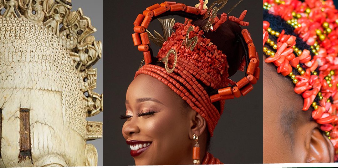
The state developed an advanced artistic culture, especially in its famous artefacts of bronze, iron and ivory. These include bronze wall plaques and life-sized bronze heads depicting the Obas and Iyobas of Benin. The most well-known artefact is based on Queen Idia, now best known as the FESTAC Mask after its use in 1977 in the logo of the Nigeria-financed and hosted Second Festival of Black & African Arts and Culture (FESTAC 77).
European contact
Before trade and contact with Europeans, supplies of metal were very scarce in Benin and writing was not present. After the Kingdom of Benin began trading with Europeans at the end of the 15th century CE, the number of bronze castings and thickness of casting had greatly increased; before trade with Europeans, the blades were incredibly thin and only wealthy elites could afford to work with these metals that were regarded as precious. Writing was not introduced to the Kingdom of Benin until the colonial period — near the end of the 19th century CE.
The first European travelers to reach Benin were Portuguese explorers under João Afonso de Aveiro in about 1485. A strong mercantile relationship developed, with the Edo trading slaves and tropical products such as ivory, pepper and palm oil for European goods such as manillas and guns. In the early 16th century, the Oba sent an ambassador to Lisbon, and the king of Portugal sent Christian missionaries to Benin City. Some residents of Benin City could still speak a pidgin Portuguese in the late 19th century.
The first English expedition to Benin was in 1553, and significant trading developed between England and Benin based on the export of ivory, palm oil, pepper, and later slaves. Visitors in the 16th and 19th centuries brought back to Europe tales of “Great Benin”, a fabulous city of noble buildings, ruled over by a powerful king. A fanciful engraving of the settlement was made by a Dutch illustrator (from descriptions alone) and was shown in Olfert Dapper’s Naukeurige beschrijvinge der Afrikaensche gewesten, published in Amsterdam in 1668.
The work states the following about the royal palace: The king’s court is square and located on the right-hand side of the city, as one enters it through the gate of Gotton. It is about the same size as the city of Haarlem and entirely surrounded by a special wall, comparable to the one which encircles the town. It is divided into many magnificent palaces, houses and apartments of the courtiers, and comprises beautiful and long squares with galleries, about as large as the Exchange at Amsterdam. The buildings are of different sizes however, resting on wooden pillars, from top to bottom lined with copper casts, on which pictures of their war exploits and battles are engraved. All of them are being very well maintained. Most of the buildings within this court are covered with palm leaves, instead of with square planks, and every roof is adorned with a small spired tower, on which casted copper birds are standing, being very artfully sculpted and lifelike with their wings spread.